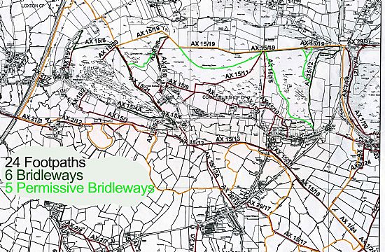
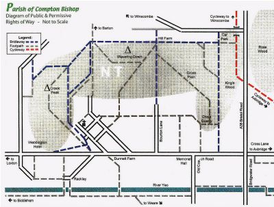
The parish has a large number of footpaths and bridleways. There are 25 public rights of way (PROW’s), 6 bridleways and 5 permissive bridleways. The map below shows their location and reference numbers. Note that this map does not include the permissive bridleways, these will be added when these routes have been approved and numbered.
Somerset Council Public Rights of Way have developed their website to show all footpaths and details of gates, stiles, etc. It also has the facility for walkers to report any problems directly to their PROW Officers.Somerset Public Rights of way-Report an issue with Explore Somerset
Have a look at a clear definitive map of Compton Bishop Footpaths and Bridleways by clicking here.
Why not try out a circular route from Rackley to Crook Peak and more Bishop? Click here for Sue Gearing’s guide
Cross Lane Footpath
The first phase for improvments to the footpath from the A38 junction to the public right of way at Springs Farm is complete. The next phase is to improve the access to Axbridge.
For many years the safety of pedestrians and cyclists, with regard to Cross Lane and their safe access to facilities in Axbridge, has been an issue.
Planning policies have designated Axbridge as a ‘Key Rural Settlement’ providing facilities such as shops and post office, which no longer exist in other rural settlements. Access to this Key Rural Settlement should be available by sustainable transport as well as vehicular access.
If you are willing to lend your support in any way please contact Tess Gill